The agricultural sector is increasingly turning to technology-based solutions to achieve greater efficiency and increase crop yields. One of these solutions is AI-assisted analysis using satellite and drone technologies. In this article, we will examine how this innovative approach can increase productivity, with a particular focus on maize field analysis.
Maize Field Analysis: Why is it important?
Maize is a staple food and industrial raw material worldwide. Therefore, increasing maize production and improving its quality becomes an important goal in the agricultural industry. However, achieving these goals relies on accurate data and efficient decision-making processes.
Satellite Imagery and Use of Drone Technology
Satellite and drone technologies for maize field analysis offer agricultural professionals a more detailed view of the situation on the ground. Satellite imagery can cover large areas and is ideal for tracking changes over time. On the other hand, drones provide higher resolution imagery from lower altitudes, allowing you to obtain more precise data.
Artificial Intelligence and Data Analytics
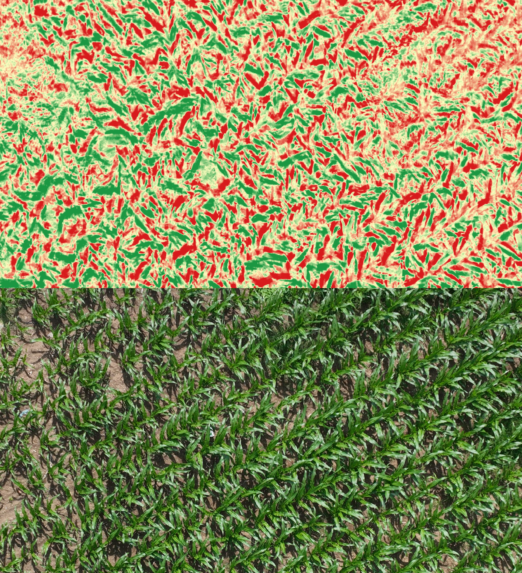
The real value for maize field analysis lies in combining this image data with artificial intelligence and data analytics. Here are some AI applications you can use at this stage:
Plant Counting: Drone and satellite imagery can be processed with AI algorithms that can automatically count the number of plants in the field. This is important for monitoring plant density and adjusting planting or maintenance operations as needed.
Plant Health Monitoring: Artificial intelligence can extract important information on plant health. It can detect the stress levels of plants, the presence of pests or signs of disease. This can be critical for early intervention.
Yield Predictions: Artificial intelligence can make predictions for maize yield. This is useful for planning the harvest period and getting the product to market.
Advantages Obtained
There are many advantages to using satellite and drone-based AI for maize field analysis:
Speed and Scale: Satellite and drone technologies can quickly scan large areas and generate large data sets.
Precision: Drones provide high-resolution imagery, which allows you to perform more precise analyses.
Data-Based Decisions: Artificial intelligence helps you make decisions based on data, which can increase crop yields and allow you to use resources more efficiently.
You can increase agricultural productivity by combining satellite and drone technologies and artificial intelligence for corn field analysis. These technologies help you make decisions based on accurate data and optimise your maize production.
Get in touch with us!
Do not hesitate to contact us to learn more about the latest developments in agricultural technologies and to get detailed information about the products and services offered by Agrovech. You can visit our website at www.agrovech.com or use the contact details below to contact us directly:
- E-mail: [email protected]
- Address: Sakarya Teknokent Esentepe Mahallesi Akademiyolu Sokak Technology Development Zones
Building:2 – ROSEM No:21
As Agrovech, we continue to offer smarter, more sustainable and more efficient solutions in the agricultural industry. We are happy to help you and contribute to the agriculture of the future. Contact us to offer customised solutions for your needs and let’s shape the future of agriculture together!
